Hello
Is it possible in MesoMap insert in order to visualize a soil temperature?
If so, how?
Thank you.
Serge
Hello
Is it possible in MesoMap insert in order to visualize a soil temperature?
If so, how?
Thank you.
Serge
Which ‘MesoMap’ are you asking about? URL to page?
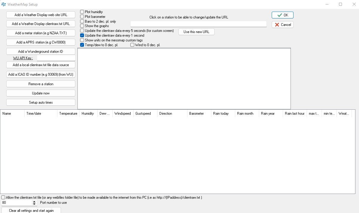
Ahh… that’s the Weather-Display built-in MesoMap feature. As you can see from the options, you are constrained to use only the following data sources:
and none of those include any soil temperature info, so, no… it can’t be used to visualize soil temperature. Sorry…
(Translate)
Thank you for this information. This is a pity.
A question, are there any independent scripts for Mesomap compatible with clientraw?
Yes, I have a regional mesonet map script set at Saratoga-Weather.org - Scripts - Regional Mesonet Google Map but… that does require a regional hub site for operation.
You appear to be in France, and unfortunately, there is not a regional network for France, so that script would not work for you.
There are multiple members of the European weather network (https://euweather.eu/) in France … you could sign up there, then use the Global map (Saratoga-Weather.org - Scripts - Global Leaflet Map ) to display on your website.
Thank you for this information.
Serge
(Translate)
Brian solved my request.
Thank you.
Serge