Hi,
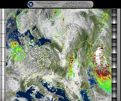
recently I’ve been busy with setting up the system to receive satellite images from NOAA15, NOAA18, NOAA19 and METEOR M2 3. Even though the first attempt was extremely successful (=pure luck), all further improvements resulted in worse and worse reception.
I started with a simple V-dipole which I made of precisely cut aluminum 4mm rods and connected them in 120° shape and further to the coax and RTL-SDR. I sat 1 metre away from the “antenna” with a laptop and received a nice image of clouds, precipitation, etc.
Later I set up a RPi with a RaspiNOAA image that contains all software required. Connected to the same antenna and placed to a more open space, results were not as good as from the first try. It is true my location is not OK as I live in a valley surrounded by mountains but anyway.
I then started working on a QFH antenna. I used the calculator and pre-cut the wires to exact lengths, etc. The frequency matching was completely out; it was somewhere at 131 MHz but I’d expect it to be just over 137 MHz. With more aggressive approach, I shortened the loops for a significant amount and finally achieved the best matching at 137.5 MHz with about 15 dB.
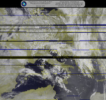
Yesterday evening there was a 89° (basically an overhead) pass but the image was a disaster.
I have no idea what to do next. Does anyone here have a working QFH antenna? If so, could the wiring be explained? There are several examples available but they vary a bit and I got confused. I use a solid copper wire (3 mm diameter), not a copper tube.
Thanks!

