I’ve tidied up a little.
I’ve removed the old versions of the script. The first post in the thread has the v1.4 3 hourly script attached. I’ve left the one hourly v1.3 script attached elsewhere in the thread for people who need it.
I’ve also modified the instructions in the first post to reflect the current version of the script, including the extra two parameters/prompts. I’ve also attached a copy of cbarm.gs which you need to run the scripts. This gives the nice colour bar on each chart.
Is anyone still using the OpenGrads scripts, particularly v1.4? I’m starting to re-install my web site now that I’ve got a Windows 11 virtual PC out in the wild. I’ve installed OpenGrads v2.2.1 and the latest map generating script (v1.4-3hr) and I’m finding two issues:
- I get DODS OpenDap errors from time to time. I know other have seen that so I guess it’s just part of life these days.
- The script doesn’t seem to be generating maps for the requested hours. I’m getting data which is 3 times as many hours in the future as I expect, I think I’ve found a solution but I was wondering whether others are seeing the same problem. It may be a recent change to the DODS data or OpenGrads, or something weird happening with my ‘server’.
Hi Chris,
Well I was up until early September this year, you can see by the maps on my site here https://beaumaris-weather.com/wxgfs_slp.php .
I gave up for a couple of reasons.
1: The issues you mentioned above, one run OK the next not then 3 good ones then nothing, so inconsistent.
2: I thought that now I’m mixing ECMWF at 80% with GFS 20% in WxSim, that it would be pointless displaying GFS maps on my site, although I love the visual effect of it. Pitty spent 100’s of hours over the years on them. I only uploaded the files so you could see them as I deleted them along with menu ref’s back in September.
Be nice to output a map from WxSim Mix 
Was good while it lasted.
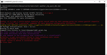
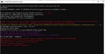
Here’s some of the errors I get, there are heaps more malformed etc. errors running it 5 mins later.
Hi Chris,
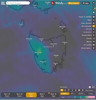
On another of my templates I have elected to just display Windy maps. That way I can view the Overall Dif between Models.
https://beaumaris-weather.com/BWX/windyforecast.php
If you click on the View Full Screen links for say RAIN ACCUMULATION, you will see ECMWF Model is selected, there are 3 more GFS and ICON and ACCESS which is the Australian/UK ( [http://www.bom.gov.au/australia/charts/about/about_access.shtml]) Model. I just hought it was easier just doing it that way.
I’m guessing that the DODS interface isn’t used as much so when it breaks not many notice and report a problem. As I already download a lot of GRIB2 data I’m going to investigate how to modify the script to use that data. If I can get that working for GFS then as I also download ECMWF GRIB2 data I might try to create my own mixer to create a mixed GRIB2 file to plot charts from. Something to keep me busy whilst it’s raining, which seems a very regular thing this year.
I don’t see how we could get a map from WxSim. Whilst it does use geographic data, its purpose is generating a hyper-local forecast so you only get a single data point for your map.
Your Windy maps are interesting. Are they free to download? I use Windy (Premium) on my phone but I’ve never looked at their web site.
A post was split to a new topic: OpenGrads maps using GRIB2 data
Hi Chris, Yes Windy is free, just embed them on your page in an iframe.
I upload data to Windy so they would not want to charge 
Kind Regards,
Tony


